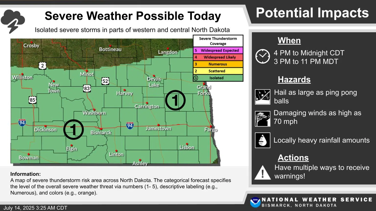
UPDATE: 2 PM 7/14
The National Weather Service has issued an updated forecast. Western and central North Dakota could see isolated severe thunderstorms Monday afternoon and evening. The southwest and south central areas face the highest risk this afternoon due to hot, humid conditions. Tonight, isolated severe weather may develop across most areas except the far northern counties. Primary concerns include hail potentially reaching ping-pong ball size and damaging winds up to 70 MPH. Heavy downpours are also likely from south central through eastern North Dakota. These conditions are expected from 4 PM to 12 AM Central.
ORIGINAL STORY:
Monday will begin with mostly sunny skies, but more damaging thunderstorms could affect southeastern North Dakota this afternoon.
The most severe parts of the storms affect eastern South Dakota and southern Minnesota, with rural areas in southeastern North Dakota under a severe storm watch according to the National Weather Service in Grand Forks.
The heaviest parts of the storm could bring wind speeds of up to 60 miles per hour, damaging hail and unlikely, but possible tornadoes.
Non-severe storms are expected to impact a wide swath of North Dakota from Steele, north to Devils Lake, and throughout eastern North Dakota and northern Minnesota with heavy rain and possible minor flooding in low lying areas.
The storms could last into the overnight hours.
Officials with the National Weather Service remind residents to have multiple ways to receive emergency alerts.
Comments