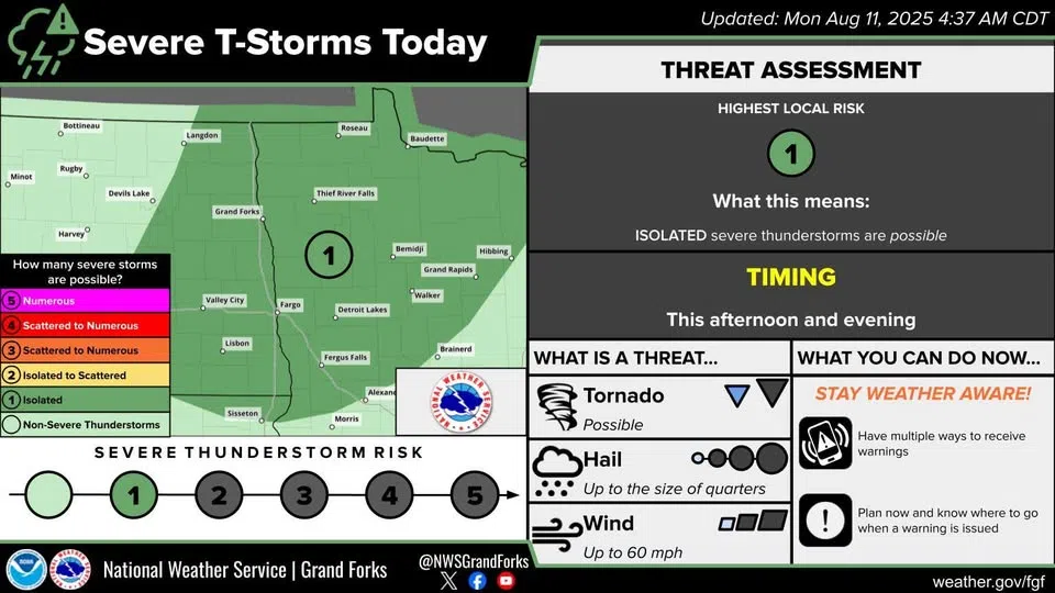
The Level 1 storm advisory, issued by the National Weather Service in Grand Forks on August 11, 2025
The National Weather Service has issued a Level 1 storm advisory for areas east of Steele and Carrington, with the I-94 corridor between Jamestown and Fergus Falls, Minnesota being in the center of the unpredictable storm path.
The central part of North Dakota will likely start feeling storm impacts in the early afternoon, with the storm warning lasting for the eastern parts of North Dakota until at least 10:00 pm.
Possible hazards from this storm include quarter-sized hail and wind speeds exceeding 60 miles per hour.
The NWS says the threat of tornadoes from this storm is low, but formations are not impossible. They are also reminding residents to have multiple ways to receive emergency alert warnings.
Comments