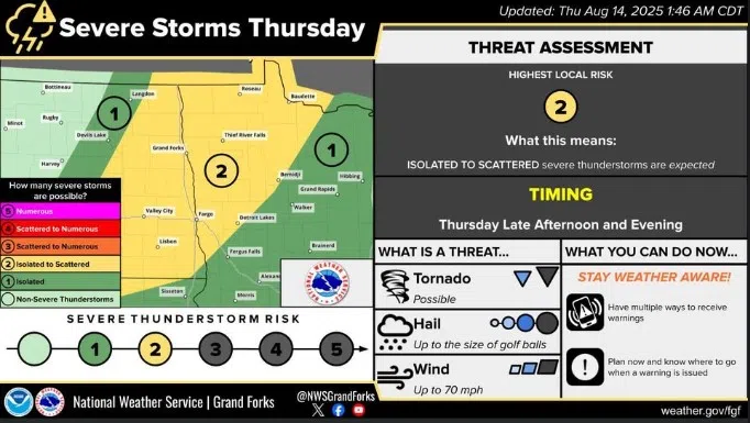
Severe storm projections for eastern North Dakota from the National Weather Service on Thursday, August 14, 2025.
Severe thunderstorms are likely again today in eastern North Dakota, according to the latest projections.
The National Weather Service has kept today’s storm warning at a Level 2 Threat Advisory for southeastern North Dakota and northern Minnesota.
The initial formations of this storm could happen mid-afternoon in the northern part of the state. The NWS says residents north of Highway 2 in eastern North Dakota should be aware of possible supercell formation.
Southeastern North Dakota could be impacted by this storm through the overnight, with initial impacts being felt sometime this evening.
These initial formations will likely be capable of forming clusters and rapid-formation tornadoes.
Tornadoes are possible, as is golf-ball sized hail and wind speeds greater than 70 miles per hour. The NWS says the storms could be very severe during their initial impacts, especially in the northeastern part of the state.
People in eastern North Dakota are advised to have a response plan ready should local officials activate warning and alert systems. The National Weather Service also advised people to multiple ways to receive emergency alerts, and to charge phones and other batteries in case power is disrupted.
Comments