A map of possible severe thunderstorms forming on Wednesday, August 20th, 2025 as forecast by the National Weather Service in Grand Forks.
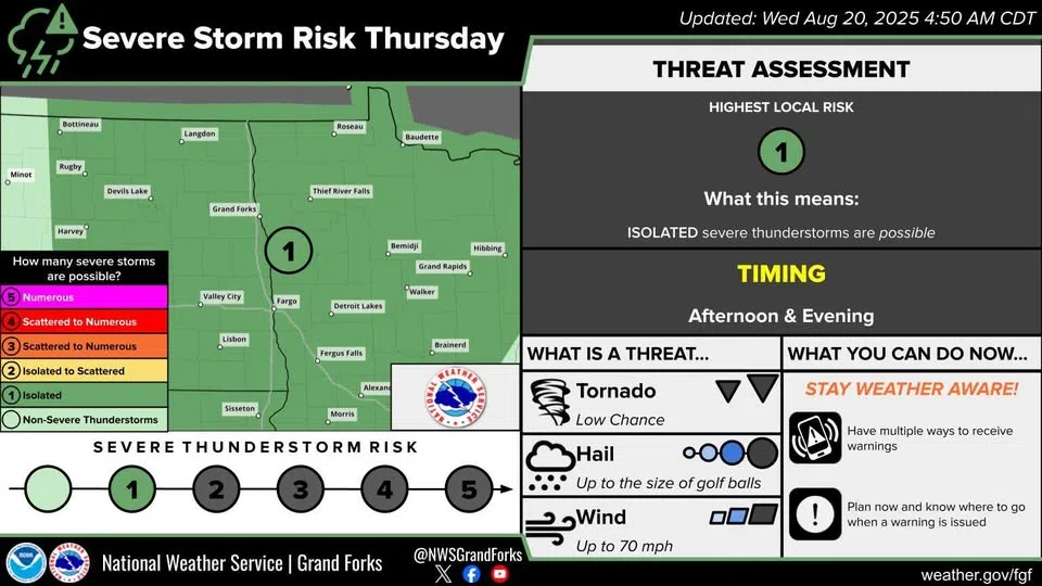
Hot, humid weather across eastern North Dakota could cause moderate-to-severe late afternoon thunderstorms, according to the National Weather Service in Grand Forks.
Meteorologists there say those storms could form in the late afternoon and evening if the heat and humidity build up enough during the day. If the systems form, they could bring golf-ball sized hail and wind speeds over 70 miles per hour. It’s extremely unlikely tornadoes form, but not impossible according to the NWS.
The central and western parts of North Dakota are unlikely to be affected by severe storms today.
The forecast calls for possible scattered thunderstorms on Thursday, then a windy, sunny day for Friday.
Comments